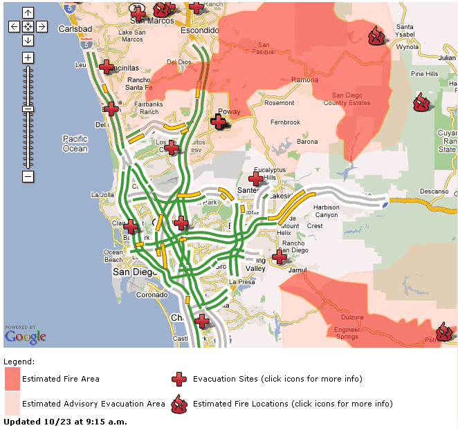
 I think it is still hard for the authorities to know what is going on. The best map I’ve seen is coming from this site: www.signonsandiego.com/firemap/.
We live in the bottom left (southwest) corner of the map. The winds are mostly blowing to the west (right to left). There are some reports of the winds going more southwest, which points them at us more.
Right now, the wind in Pacific Beach is blowing in from the ocean. That is good for us, but it may not mean much more than cleaner air. It could just be a back eddy/swirl from the wind north of us around Mt. Soledad.
Evacuations are getting closer to us, but are holding steady. I still think we are in good shape where we are.
This is the latest evacuation map that I’ve found:
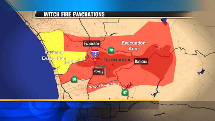
It is still north of us, but the fact that it goes to the coast is very scary to me.
Good luck, buddy. I’m keeping an eye on your blog–thanks for the updates.
Roberto La Rock